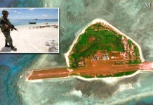
The Civil Aviation Authority of the Philippines said that it would install a flight-tracking system in the disputed West Philippine Sea after China’s landing of several aircraft on its man-made island.
The automatic dependent surveillance-broadcast (ADS-B) machine can detect aircraft positions using satellite signals. The flight-tracking device will be operational by November and will be installed in Pag-asa island, a filipino occupied island in the Spratlys, acting director of the CAAP, Rodante Joya said.
The surveillance system was part of a P10 billion effort to expand the country’s commercial flight radar coverage from the current 30 percent to 80 percent.
“Our objective is to track all commercial flights passing over our airspace,” Joya said

China has build at least 3 runways and massive buildings in their man-made islands in the West Philippine Sea which is claimed by by the Philippines, Vietnam, Brunei and Taiwan.
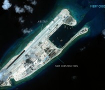
China’s test flights in Kagitingan Reef (Fiery Cross Reef) has concerned the Philippines saying it would lay the groundwork for the declaration of an air defence identification zone (ADIZ) like what happened in East China Sea that angers Japan, in 2013.
A CAAP plane on January 6, was about to land on the island when it receive message from the Chinese Navy discouraging them from landing, Joya said.
The exact message the Chinese Navy according to the report was: “Foreign military aircraft this is the Chinese Navy, you are threatening the security of our station.”
The Philippine Foreign Affairs has been informed about the incident, said Presidential spokesman Herminio Coloma. -John Esconde

